Topographical approach to “expressive continuity”.
URBAN DEVELOPMENT CONCEPT
The new quarter is located in a topographically challenging situation between the towns of Erlenbach and Neckarsulm and lies between industrial areas and the A6 highway. Local land uses such as the elementary school, a daycare center, vineyards connected to the Vinosphere, a bakery, a topographical high point to the highway and varied field structures with an incredible expanse form valuable existing points of reference, which our urban design aims to orient and connect.
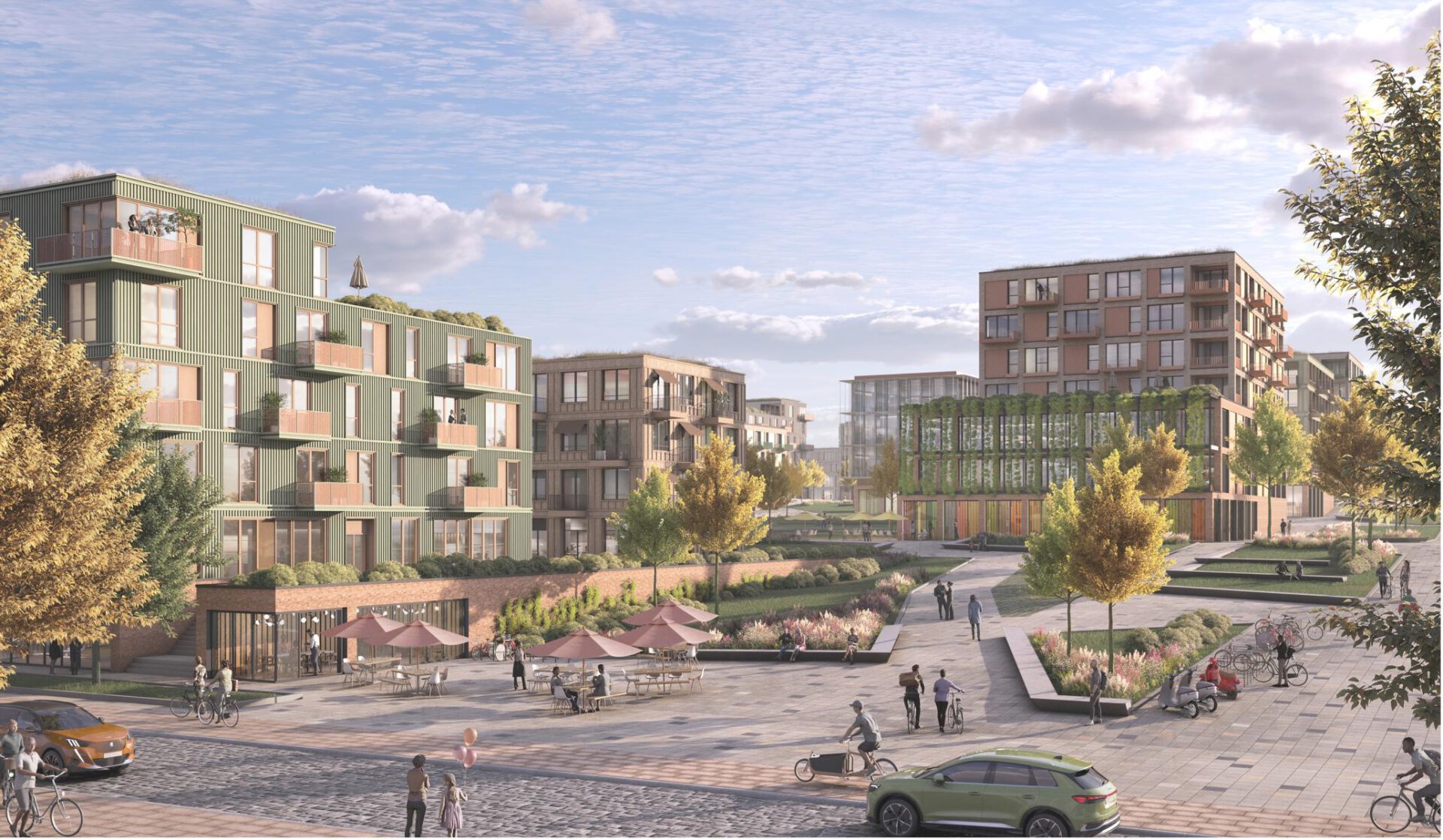
We have laid a new road development through the plan area in such a way that it can serve building plots, squares and parks on both sides in an area-optimized manner and connects with the existing road network to form a “loop” around the district.
It serves motorized private transport, deliveries and public transport. It is followed by a cycle path in both directions for intra-area connections. All paths leading from the main road are designed as “shared space”, in the sense of a low-traffic and pedestrian-friendly city center between the building plots. They provide ground-level and barrier-free access to every building. All of these zones offer unobstructed views and connections to nature, squares and the central park axis.
The orientation of the building volumes aligns the new urban development with existing building structures that characterize the area so that it blends into the surroundings in a comprehensible manner. Based on the steeply sloping topography, the building plots are oriented in a clear grid, so that functional and optimized terraces can be created on the site. The jury praised “the moderate grain” and its accompaniment “with well-functioning building sizes” as well as the handling of the topography of the neighborhood squares, an “expressive continuity across the sequences of squares”.
In this clarity of the grid, which creates optimally usable spaces, a central park ribbon meanders through the quarter and playfully jumps around in the zoning, creating a varied alternation between squares, open spaces and green zones.
The central park ribbon acts as a buffer zone between the different gradients of the building plots and thus enables barrier-free crossing connections and natural retention areas in the urban context.
The design aims to achieve clarity in comprehensible zoning, sequences and addressing, while at the same time providing a variety of different visual relationships and playful connections. The aim is to create a quarter in the sense of free experience, through which one can drift, walk and discover everything.